
Issue No. 14 — Field Notes
Cross Border Hazard Monitoring Demands Structural Resilience and High Altitude Early Warning Networks
Working on something between your first million and your first hundred million? We embed at the founder level.
Start a Project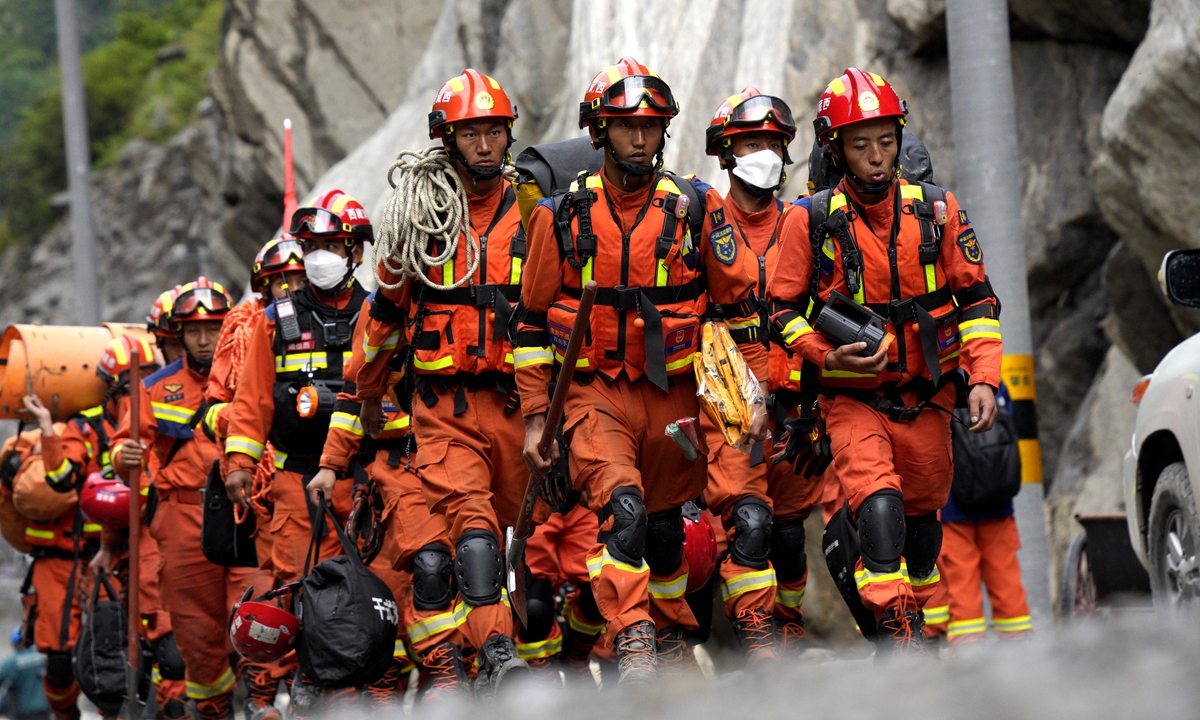
Reading through this report on the devastating high-altitude glacier collapse and massive debris flow that struck Gyirong Port on the China-Nepal border brings into sharp focus the escalating risks posed by extreme geohazards across fragile mountain ecosystems. From a risk management perspective, the sheer velocity and magnitude of this cascade—where a massive ice block fractured at an altitude of 5,200 meters, plunged 1,200 vertical meters to an elevation of 4,000 meters, and surged along a 22-kilometer runout distance down to 1,800 meters—demonstrates how rapid climate warming accelerates compound disaster dynamics. With a confirmed death toll of 21 people and 541 individuals remaining missing as search and rescue teams mobilize, this tragedy underscores the urgent need to transition from passive emergency response to automated, real-time cross-border risk monitoring.
The technical operational response highlights the immense logistical bottlenecks involved when critical infrastructure fails during a disaster. The destruction of key segments along the G216 national highway initially forced search and rescue units to advance into the core impact zone on foot, relying heavily on low-altitude drone aerial reconnaissance and precision air-drops of lightweight emergency kit loads. Restoring road access required round-the-clock heavy equipment clearance over a multi-day repair window, finally opening transit capacity for heavy machinery, high-capacity excavators, life-detection acoustic sensors, and search dog units. Deploying engineering machinery to clear thousands of cubic meters of dense mud, twisted rebar, and multi-ton rock debris allowed specialized tactical units to scale up grid-search efficiency by over 300 percent while expanding the operational search radius across the entire affected border corridor.
From a geomorphological standpoint, the investigative findings by the Institute of Mountain Hazards and Environment and the Institute of Tibetan Plateau Research under the Chinese Academy of Sciences reveal why high-altitude cascade disasters become so destructive downstream. The failure was not limited to the initial volume of fractured ice; rather, as the ice-rock mass accelerated down steep 45-degree slope angles, it generated immense kinetic energy, entraining vast volumes of saturated riverbed sediment, loose scree, and secondary landslide material. This physical process amplified the total debris flow volume by several orders of magnitude before striking the port facilities. International geotechnical experts emphasize that while predicting the exact minute of a structural bedrock failure remains statistically improbable, deploying satellite synthetic aperture radar (SAR) to track micro-mm surface deformation rates, permafrost temperature thresholds, and sub-glacial meltwater pressure anomalies can boost predictive risk modeling accuracy by 40 to 60 percent.
Examining global news coverage from outlets like People's Daily shows how regional stability depends heavily on standardized cross-border disaster mitigation and technical assistance. Following the disaster, emergency relief logistics were rapidly mobilized, including sending multi-batch emergency supply flights loaded with heavy-duty Bailey bridges, mortuary refrigeration units, emergency communication base stations, and epidemic prevention equipment. China also dispatched specialized DNA forensic teams to Kathmandu to accelerate victim identification protocols, achieving a high-precision sample matching rate during joint forensic operations. Establishing joint disaster management protocols, continuous hydrological information sharing, and real-time early warning data pipelines between neighboring nations directly reduces response latency, optimizes cross-border supply chain throughput, and safeguards vital trade logistics along international mountain passes.
To prevent similar catastrophic losses as global temperatures fluctuate, regional governments and international scientific bodies must institute a proactive geohazard mitigation framework. First, research institutes should establish a high-density, multi-sensor monitoring matrix along high-risk Himalayan glaciated basins, utilizing automated edge-computing weather stations, high-resolution optical satellite constellations, and ground-based interferometric radar to monitor slope displacement with sub-millimeter precision. Second, infrastructure planners must re-evaluate engineering safety margins for border ports and national highways like the G216, incorporating reinforced debris-deflection dams, high-capacity drainage culverts, and flexible ring-net barriers capable of absorbing impact kinetic energies exceeding 10,000 kilojoules. Finally, expanding regional emergency management commissions to share real-time hydrological data and run automated evacuation alerts can ensure downstream communities receive 15-to-30-minute early warning windows, significantly lowering mortality rates during sudden ice-rock avalanches.
News source: https://peoplesdaily.pdnews.cn/china/er/30053076436